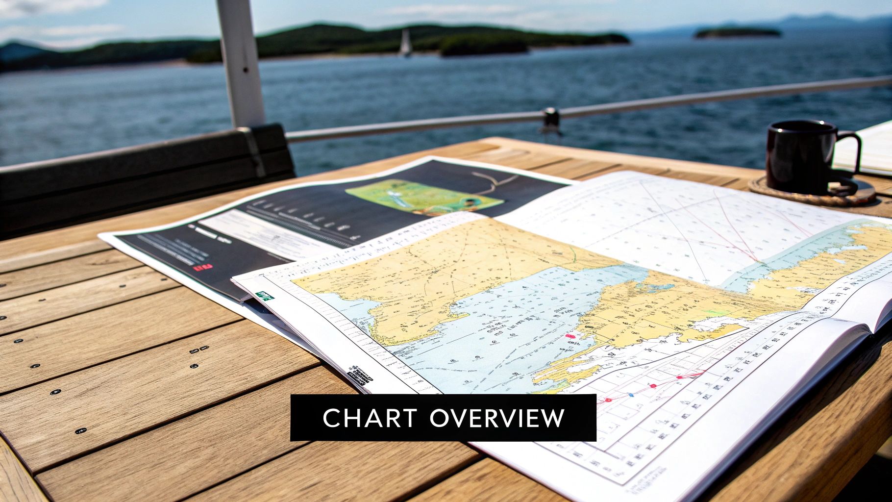
Forget dry textbooks. A nautical chart isn't homework; it's your treasure map to the ultimate day on Lake Travis. Imagine confidently guiding your crew to a hidden cove, knowing exactly where the deep water is, and navigating like a pro. This isn't just about safety—it's about unlocking a whole new level of freedom on the water.
Once you know how to read the map, you can spot water depths, find key markers like buoys, and plot a course to the best spots on the lake. Master these simple secrets, and you'll be ready to captain an unforgettable experience. Your epic day is just one booking away.
Your Adventure Awaits—Book It Today!
Picture this: you’re at the helm of a beautiful boat, the Texas sun is warming your skin, and the stunning waters of Lake Travis are all yours to explore. This isn't a dream. This is the adventure you can book right now. Learning to read a nautical chart is the key that turns a good day into a legendary one.
This guide is your shortcut to becoming the hero of your trip. We're skipping the jargon and getting straight to the practical knowledge you need to spend less time guessing and more time creating amazing memories on one of our premium rental boats.
Why This Skill Unlocks the Best Experience
Understanding a chart is your ticket to ultimate freedom on the lake. It empowers you to venture beyond the crowds and discover the hidden gems that make Lake Travis so incredible. When you can confidently chart a course, you're not just renting a boat—you're taking charge of an epic adventure.
It means you can finally:
- Discover Secluded Coves: Find those quiet spots perfect for a private swim or just dropping anchor and relaxing away from everyone else.
- Navigate with Total Confidence: Weave through the lake like a seasoned pro, easily avoiding shallow spots and known hazards.
- Maximize Your Fun: Squeeze every drop of adventure out of your rental time instead of wasting it feeling lost or uncertain.
The real magic happens when you have the skills to lead your own journey. That chart is the tool that makes it all possible, turning a simple boat rental into the highlight of your year.
Learning to read a Lake Travis chart is far easier than you think. You don't need to be a seasoned sailor; you just need to know a few key symbols to unlock the entire lake. My goal is to get you so excited and prepared that you can't wait to get on the water.
Once you have these skills, you’ll see the lake in a new light. You'll be able to find the perfect spot for a party, cruise over to hotspots like Devil's Cove, and return to the marina feeling like a total boss. This guide gives you the know-how; our fleet provides the perfect vessel for your adventure. Go ahead, browse our incredible boat rentals on Lake Travis and start planning the day you deserve.
Decoding the Secrets Beneath the Water
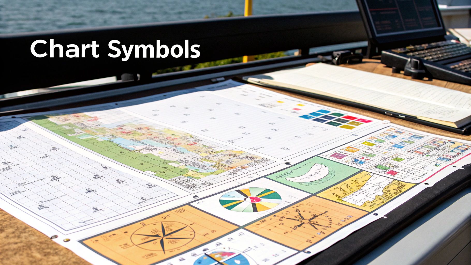
Ready to see what’s really going on beneath that beautiful blue surface? A nautical chart might look complex, but you only need to master a few key elements to navigate Lake Travis with total confidence. This isn't about memorizing a textbook; it’s about giving you the power to captain your rental boat like you own the place.
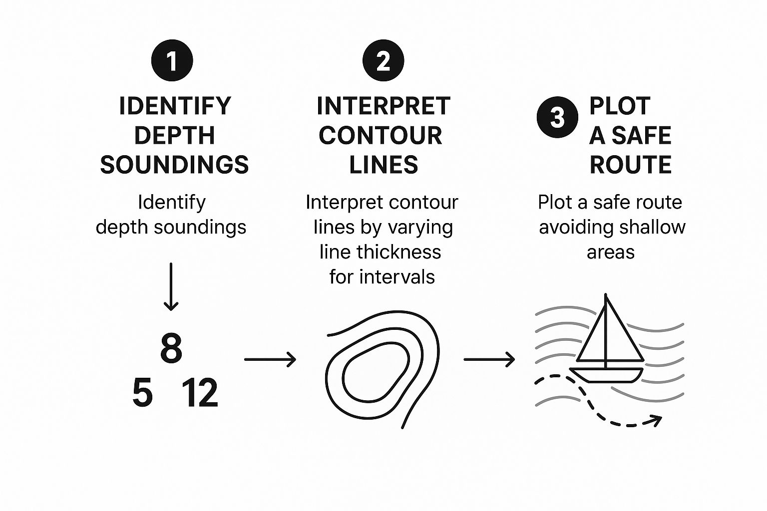
The first thing to look for are the numbers scattered across the chart. These are soundings, and they are your absolute best friend. They tell you exactly how deep the water is, letting you steer clear of shallow spots and find the perfect cove to drop anchor and swim. They are your secret weapon for a stress-free day of fun.
It's pretty amazing to think about the history here. Early American coastal charts were notoriously unreliable until a more systematic approach to surveying was finally established back in the 1830s. This methodical process of taking soundings, mapping shoreline topography, and using triangulation laid the foundation for the incredibly detailed maps we trust today. It's wild to see just how far the craft has come!
Reading Depths and Contours
Those numbers are just the start. You’ll also see lines snaking across the chart—these are depth contour lines. They connect points of equal depth, giving you a 3D picture of the lake floor.
When these lines are spread far apart, it means a gentle, sloping bottom. That’s easy cruising territory.
But when those lines are packed tightly together? That’s your heads-up for a steep underwater drop-off. Visualizing these contours turns a flat piece of paper into a powerful navigation tool, which is crucial on Lake Travis, where water levels change. For a full breakdown, check out our guide on how deep Lake Travis is in Austin, Texas.
Spotting Hazards and Aids to Navigation
Your chart is also your guide to avoiding party-spoilers and finding helpful markers. Keep a sharp eye out for these essential symbols:
- Submerged Dangers: Symbols like
Rkfor rock or a circle of dots around anobstn(obstruction) are your "steer clear" warnings. They mark things you definitely don't want your propeller to meet. - Navigational Buoys: These are your traffic signals on the water. Red and green buoys mark the safe channels. The classic sailor’s trick to remember is “Red, Right, Returning,” which means you always keep the red buoys on your right-hand side when you're heading back to the marina.
The goal is to make reading the chart feel as natural as checking your rearview mirror. It’s all about quick glances and instant understanding, freeing you up to focus on the sun, the fun, and the incredible views from the deck of your boat.
Once you master these symbols, your whole mindset shifts. Instead of feeling uncertain, you’ll feel totally empowered. You’ll be the captain who knows exactly where to find the best swimming spots and how to get there safely. This is the confidence that turns a good day on the lake into an absolutely epic one.
Mastering Your Compass to Find Hidden Gems
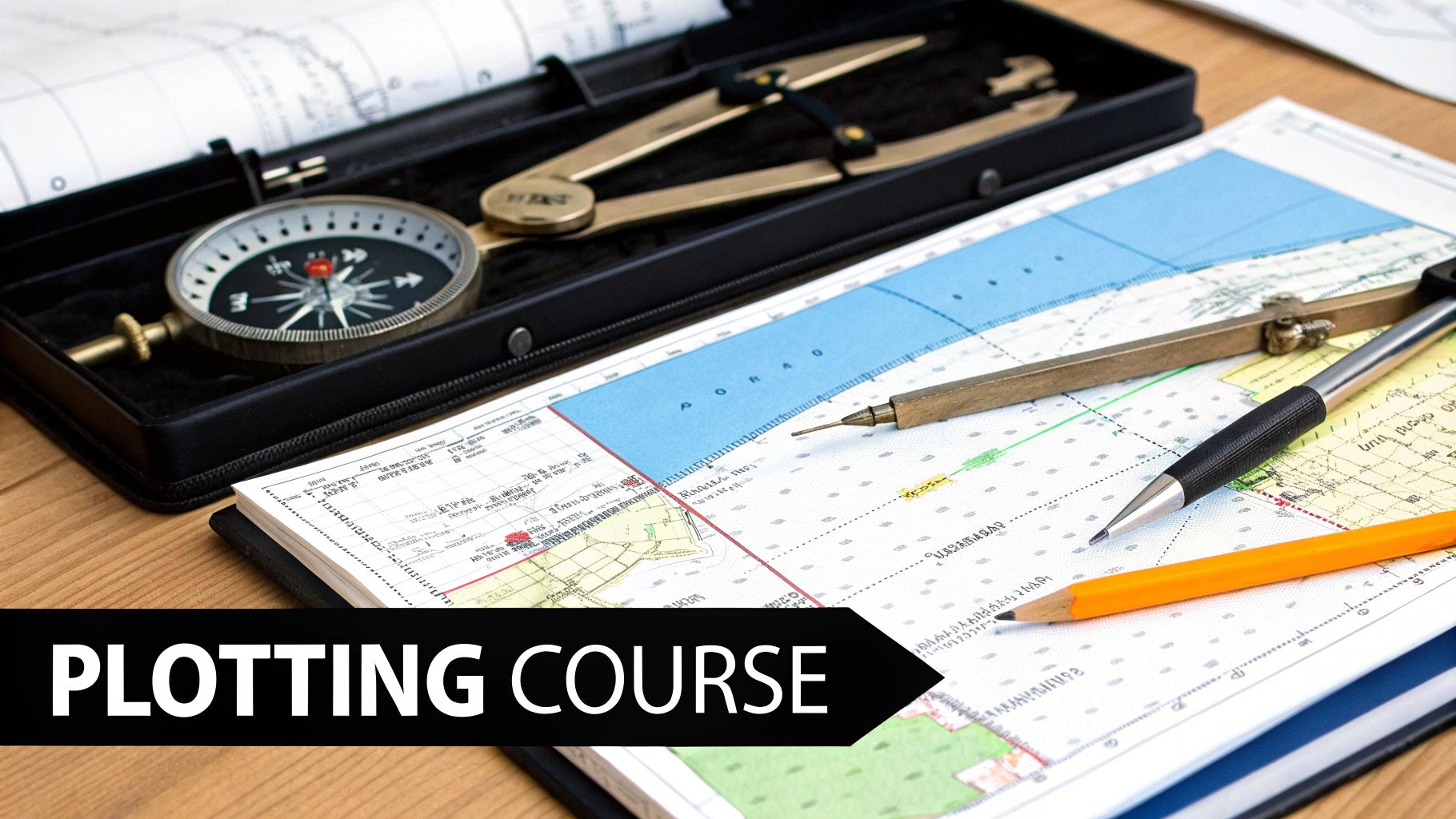
This is where you go from just driving a boat to truly commanding your adventure. Knowing where you are and where you're going is the key to confident boating. The tool that makes it all happen is that circle on your chart called the compass rose. Think of it as your mission control, turning a simple map into your personal guide to the best spots on Lake Travis.
A compass gives you a clear direction, or bearing, to your next destination. Suddenly, you're not just cruising—you're navigating with purpose. This is exactly how you discover those incredible hidden coves and quiet swimming holes that make for the best stories.
True North vs. Magnetic North Made Simple
Let's quickly tackle something that sounds complicated but isn't: the difference between true north (the actual North Pole) and magnetic north (where your compass points). On the chart's compass rose, you'll see two circles. The outer one is for true north, and the inner one is for magnetic north.
The small difference between them is called variation, and it's listed right there for you.
For a day of fun on Lake Travis, you don't need to be a geophysicist. Just know which "north" your compass uses and stick to that circle on the chart. That's it! It's a skill built on centuries of know-how, starting back in 1599 when Edward Wright’s work with map projections let sailors plot straight-line courses. By 1631, Pierre Vernier's instruments were precise enough to get a ship within a nautical mile of its position. You can get a sense of how these [foundations of navigation](https://en.wikipedia.org/wiki/History of navigation) were laid down long ago.
Using Landmarks to Pinpoint Your Location
Now for the fun part! This is where you connect the map to the world around you. Prominent shoreline features—a distinct cliff face, a water tower, a familiar marina—are your best friends. By taking a compass bearing from your boat to two different landmarks, you can draw intersecting lines on your chart to pinpoint your exact position.
This is a game-changer. Let's say you're out on the water and want to find the entrance to Devil's Cove. Instead of just guessing, you can plot a real course. You'd take a bearing from our dock straight to the cove's mouth, giving you a direct line to the best party spot on the lake. That’s what total control feels like.
This skill transforms you from a passenger into a true captain. To get familiar with the layout, our interactive Lake Travis Map is the perfect tool to scope out landmarks before you even get on the boat.
Once you're comfortable with the compass, you're not just reading a map; you're ready to explore, discover, and lead your crew to an unforgettable day. So, who's ready to book their adventure?
Planning Your Perfect Day on Lake Travis
You've cracked the code on chart symbols and mastered the compass. Now, it’s time to plan the incredible day you're about to have on the water. Think of this as your pre-launch checklist before you take the helm of your rental boat and create some amazing memories.
Picture this: we're on the dock, the sun is shining, and your pristine rental boat is ready to go. Our mission? A trip to the legendary Hippie Hollow Park. The first thing we do is spread out our nautical chart. This isn't just about drawing lines; it's about building a smart, safe, and totally awesome game plan.
Charting Your Adventure
As we trace a potential route, we're really reading the story of the lakebed.
First, we scan for depth numbers—the soundings. Are we seeing a healthy string of 50s and 60s? Perfect, that's a clear channel. But if we see those numbers suddenly drop to a 10, that's our cue to steer wide and keep the party going.
Next, we look for any potential party crashers. We'll hunt for hazards along our path:
- See a symbol for a rocky area, maybe an
Rk? We'll plot a course well around it. - Is there a submerged obstruction noted? We’ll make sure our path is nowhere near it.
- We'll also pick out big, easy-to-spot landmarks on the shore, like the Mansfield Dam, to use as visual checkpoints as we cruise along.
This whole process turns a paper map into your dynamic co-pilot for the day.
The Goal Here is Confidence. This walkthrough is all about giving you that unshakeable feeling that you can book your boat, take the helm, and create your own amazing Lake Travis story. It’s knowing you have the skills to not just get out there, but to truly explore.
This simple process is key to turning all those numbers and symbols into a fun and easy-to-follow plan.
So, what happens when you’re out there and spot a cool, secluded cove that wasn't on your original plan? That's the best part!
Because you have your chart and know how to read it, you can make those spontaneous decisions safely. A quick glance at the depths and any marked hazards is all it takes to confidently detour for an impromptu swim. This is the real freedom that map-reading gives you—the freedom to adventure.
To make sure you're ready for those spontaneous moments, check our guide on what to bring on a boat trip.
Now, the only thing left is to make it real. It's time to book that boat and get ready to captain your own unforgettable day on Lake Travis.
Pro Tips for a Flawless Day on the Water
You've got the chart-reading skills down. Now it’s time to get you ready for an absolutely epic day on Lake Travis. This knowledge isn't just about safety; it's your key to unlocking true freedom and adventure on the water. It’s what gives you the confidence to book a boat, grab the helm, and create incredible memories.
These are a few insider tips to make your trip smoother and way more fun. Think of this as your final briefing before you become the captain of your own adventure.
Blend the Best of Both Worlds
A paper chart is your trusty backup that will never run out of batteries, but let's be real—your smartphone is coming with you. Use both! Pairing a GPS app with your traditional chart gives you a massive advantage.
Use the GPS for a quick, "you are here" ping, but lean on your paper chart to see the big picture of channels, hazards, and upcoming landmarks. You get pinpoint precision and wide-angle perspective all at once. It's the ultimate power combo for confident navigation.
Don't Forget the Wind and a Float Plan
Your beautifully plotted course is a great start, but nature always has a say. A strong southerly wind will slowly push your boat off course. Just keep an eye on it and make small, continuous steering adjustments to stay on track.
And before you leave the dock, make a quick float plan. It’s a game-changer.
- Who: Let a friend on shore know exactly who is on the boat.
- Where: Tell them your general route and where you're headed.
- When: Give them an estimated time you plan to be back.
It takes two minutes and it's one of the smartest things any captain can do before starting their adventure.
Knowing how to read a nautical map transforms you from a passenger into a confident leader. It’s the skill that says, "I'm ready for this adventure," and it's your green light to book one of our premium boats and take charge.
The history of nautical charting is all about this spirit of exploration. The first real charts showed up in the late 13th century, but it took almost 700 years of innovation for them to accurately cover huge areas like the North Sea, evolving from simple local sketches to the incredible tools we have today. You can dive deeper into the long history of nautical charts if you're a history buff like me.
Your Adventure Is Ready to Book
You've done the homework. You know the symbols, the depths, and how to plot a course. The only thing left to do is make it happen! All this knowledge is meant for one thing: getting you out on the water to have the time of your life.
And if you're planning on staying out past sunset, our guide on navigating a boat at night will ensure you're fully prepared.
Your perfect day on Lake Travis is waiting. Book your boat online now, put your new skills to the test, and be the captain of an adventure everyone will be talking about for years.
Answering Your Top Lake Travis Navigation Questions
Getting the hang of a nautical chart is what transforms a good day on the water into a great one. It’s all about building that captain's confidence so you feel ready to book a boat and go. Now that we’ve walked through the basics, let's dive into some questions I hear all the time.
"I've Got a GPS on My Phone. Do I Really Need a Paper Chart?"
Yes, absolutely! Think of your phone's GPS as great for a quick "Where am I right now?" check. But technology fails. Phones overheat in the Texas sun, batteries die, and you can hit dead zones with no signal.
A physical chart is your never-fails backup. It doesn’t need batteries and it always shows you the bigger picture—what’s ahead, what’s around the next bend, and where the deep water is. The smartest captains use both. This combo gives you the confidence to handle anything and focus on having fun.
"What’s the Single Most Important Thing to Watch on the Chart?"
Hands down, water depth. Lake Travis levels fluctuate, so a channel that was safe last summer might be shallow today. Those little numbers on the chart, called soundings, are your best friend.
Keep a close eye on them, especially when exploring new coves. Keeping plenty of water beneath your boat is the golden rule for a stress-free day of adventure. This is the key to exploring with confidence and making the most of your rental.
My best advice? Practice makes perfect. Before you even get to the dock, grab a chart and trace a potential route from the marina to a spot like Devil's Cove. You’ll be amazed at how quickly it starts to click. This is all about getting you excited to explore, not intimidated by a piece of paper.
"Honestly, How Long Does It Take to Get Good at This?"
You'll be surprised how fast you can pick it up! For a day trip on Lake Travis, you can get comfortable with the most important elements—reading depths, understanding key symbols, and using a compass—in about an hour.
The goal is to focus on what matters for having an amazing day on the lake. Once you can spot hazards and read depth soundings, you are ready to go. All this prep work is about one thing: empowering you to be the hero of the day, confidently guiding your crew to that perfect swimming spot. You've got this! The only thing missing is your booking.
Ready to take the helm and put your new skills to the test? Your unforgettable Lake Travis adventure is just a click away. At Lake Travis Yacht Rentals, we've got the perfect captained boat for you and your crew.